Abberley
The U3A geology group visited Abberley on 13 May 2009. The trip consisted of three parts:
- Walk up Abberley Hill
- Visit the two Abberley Churches
- Visit by car down Camp Lane
In between we had an excellent lunch at the Manor Arms Inn, Abberley
Pictures of geological highlights and other items are included below.
If you want to repeat our journey, details of the trail guides you will need are detailed below.
For the walk up Abberley Hill and the Abberley Churches, there are two Earth Heritage Trust trail guides. These can be purchased from Herefordshire and Worcestershire Earth Heritage Trust; Geological Records Centre; University of Worcester; Henwick Grove; Worcester WR2 6AJ (01905 855184) ; cost around £2.
For the drive down Camp Lane, see pages 60 – 61 (section C to K) in the Geopark Way guide, also available from the Earth Heritage Trust. For directions, start at Camp Lane off the A451 (742661 on Landranger 204) and finish at Woodbury Quarry entrance (742636 – mini road towards Shelsey Beauchamp Church).
Abberley Hill
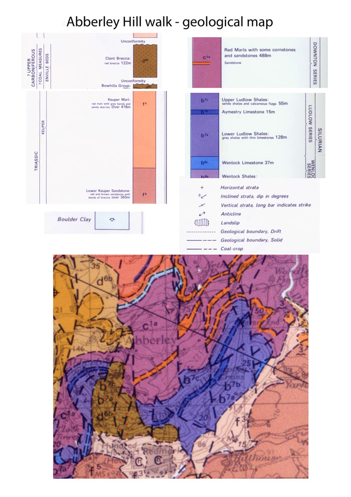
Geological map of Abberley Hill

The geologists, walking up Abberley Hill

Aymestry Limestone at Shavers End Quarry
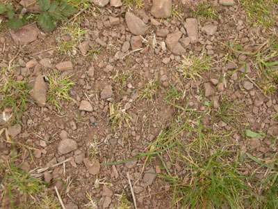
Haffield Breccia (top of Abberley Hill)
Abberley Churches – St. Michael’s
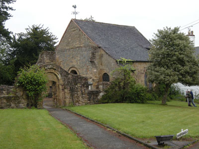
St. Michael’s Church, Abberley

Iron concretions in sandstone
Iron Liesegang banding in sandstone

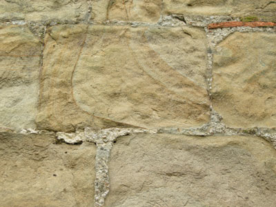
Silurian mudstone used as a construction block
Abberley Churches – St. Mary’s
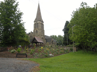
St. Mary’s Church, Abberley
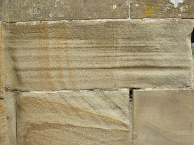
Iron oxide “Liesegang” banding on sandstone

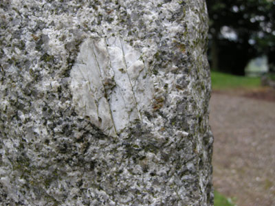
A xenolith in pink granite
Porphyritic granite with feldspar phenocryst
Camp Lane
For an explanation if the Lower Teme Valley geology, click here.
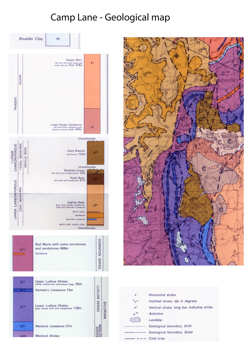
Geological map of the Camp Lane area

The geology of Walsgrove (poster)
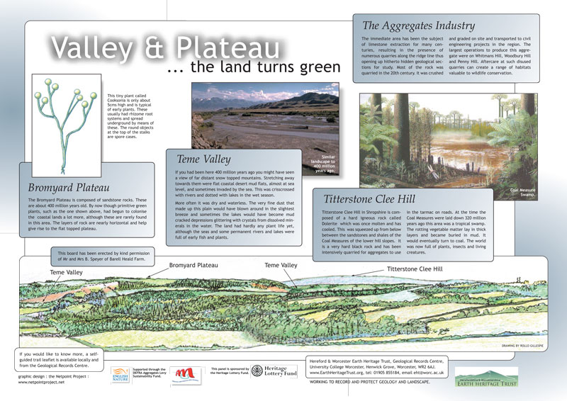
The geology of the Teme Valley (poster)
We finished off at Woodbury Quarry, sadly with no admittance to the public.
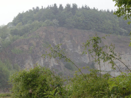
Woodbury Quarry