Bredon Hill walk
The U3A geology group had a walk up Bredon Hill on Wednesday 7 Oct 2009.
Click here for:
o A visit report on the visit by Tony Goodall, one of the U3A members.
If you want to repeat our walk, you will need the Bredon Hill (West) Earth Heritage Trust trail guide. This can be purchased from Herefordshire and Worcestershire Earth Heritage Trust; Geological Records Centre; University of Worcester; Henwick Grove; Worcester WR2 6AJ (01905 855184) ; cost around £2.
Don’t forget to click down into web links for additional information. These are generally accessed via highlighted words on the titles of the pictures.
Visit report
14 members of the group met at the Crown Public House in Kemerton on Wednesday 7th October for a circular walk of about 5 miles on Bredon Hill. The walk was organised and led by Richard Newton and James Berry.
Although we met before 9am we found the pub already open for us so we could use the facilities before starting the walk, with the landlord taking lunch orders for our return. Such impressive organisation of food and creature comforts augers well, I thought, and we were not disappointed.
Richard gave us a quick run through the geological features before we set off, explaining that Bredon Hill is an outlier of Jurassic rocks capped with Inferior Oolitic limestone, and that we would be looking at fossil evidence and some of the particular curiosities which make the hill of great interest.
We would also not forget to take in the views!
James led us north out of the village up the dip slope of the hill, a steady climb at a moderate gradient, and we were soon onto the limestone outcrop and looking at bits of rock to find the rounded grains which make up the oolite. Continuing up we came then to Sundial Farm where some of the more hawk-eyed members of the group spotted, in the blocks of the farm wall, the distinctive star shaped crinoid (sea lily) fossil, which showed up very clearly through a hand lens. Then on to the top, and the Banbury Stone, which is a haphazard arrangement of bits of rock stuck together by cementitious limestone to form a breccia. On our descent along the scarp slope we saw evidence of landslip and more breccia at the King and Queen Stones.
Quite apart from the geological interest, the views all around over the Severn and Avon valleys were stunning, with the landscape laid out like a map.
Our thanks to Richard and James for their organisation, humour, and informed leadership of our walk. The weather was kind to us, cool but dry. We enjoyed a good lunch together at the Crown before leaving.
The geology of Bredon Hill
A limestone escarpment underlies the whole of the southern side of Bredon Hill right up to the crest. This was formed on an ancient sea floor, which existed during the Jurassic period (195 million years ago). An escarpment is an asymmetrical hill or ridge, one side of which is steep (the scarp slope), the other gentle (the dip slope). The hill is formed of titled rock layers, the dip of which is roughly mirrored by the dip slope.
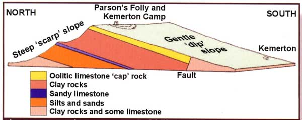
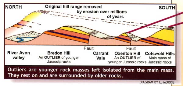
Geologically, Bredon Hill is related to the Cotswolds. They are made from the same Jurassic rocks and were initially all part of a much larger escarpment. Weathering and erosion during millions of years have carved out Bredon and other isolated hills. These isolated hills are known as outliers.
Pictures of the walk
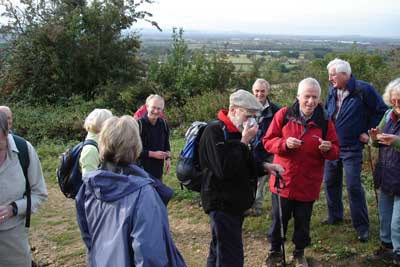
The U3A geologists at the start of the walk.
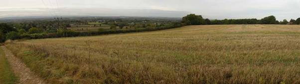
A view across the dip slope as we started to climb.
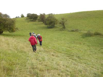
Walking along a dry river valley. These are often found in limestone hills. There is some debate as it how these dry river valleys were formed. Most likely is that they occurred when climatic conditions meant there was much more water than now.
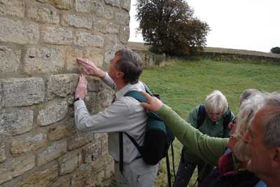
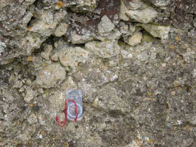
Stopped at the now deserted Sundial Farm and searched the wall for fossils and other features of interest. The wall itself is constructed of blocks of creamy brown rock called oolitic limestone.
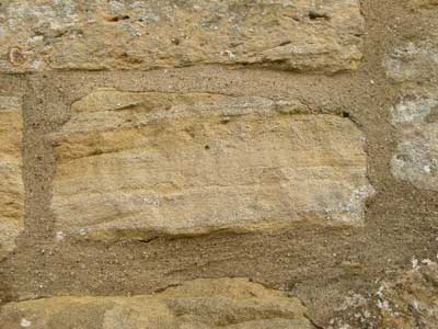
Three sets of layers are visible in this limestone block. In each case the top of the set has been scoured by the action of sea water before new layers were deposited above at a different angle. This is known as cross and current bedding.
Fossils in the walls of Sundial Farm.
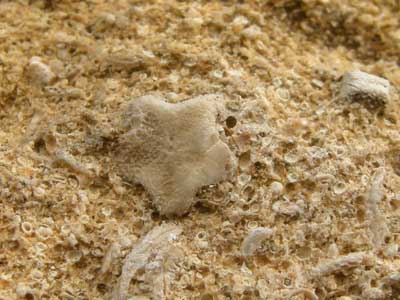
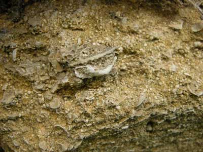
A fossil ossicle in the wall of Sundial Farm. These fossilised ossicles are the stems used to anchor sea lilies (crinoids) onto floating logs or the sea bed.
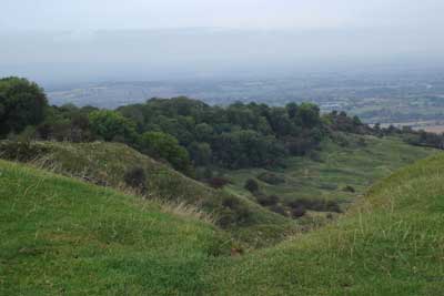
View down the scarp slope from the top of Bredon Hill.
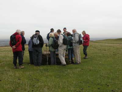
The U3A geologists reach the summit of Bredon Hill.
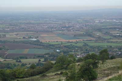
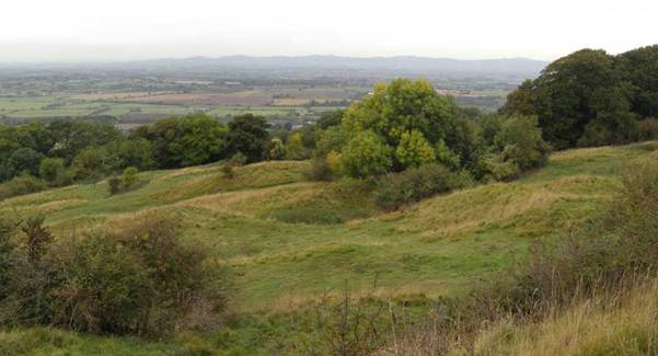
View South West from the Summit, looking across the Severn and Avon floodplain.
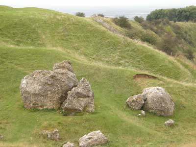
The Banbury Stone, a large rock just North of the summit. This limestone rock is called a gull rock meaning rock formed in the gulls or wide joints in the limestone.
A closer view of the Banbury Stone. It is comprised of angular fragments of oolitic limestone cement called tufa. This type of sedimentary rock is called a limestone breccia.
On the descent we encountered an area of hummocky ground. The hummocks are landslips which have broken away from the edge of the scarp slope. Landslips and mudslides disfigure the whole of the northern slope of Bredon Hill. Note the Malvern Hills on the horizon.
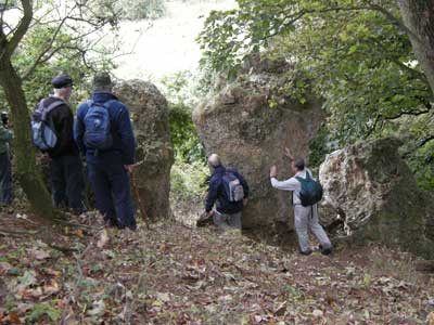
The King and Queen Stones, another example of a limestone breccia.