Richards Edward’s 2009 Lecture Field Trip
This field trip, held on 19 March 2009, was the final event from the set of lectures given to the group in the winter of 2008/9. Richard titled the lectures “Geology and Landscapes in Malvern and the Welsh Borderlands”.
Here is Richard’s Introduction to the field trip, and a list of the localities visited. Click on the localities for pictures and further details of what we saw.
Don’t forget to click down into web links for additional information. These are generally accessed via highlighted words on the titles of the pictures.
The Fieldwork Itinerary
Introduction
The aim of the fieldwork is to introduce you to a range of different rock types in the Malverns and to explain some of the key events in the geological evolution of our area. The impact of geology on the landscape is an important theme during the day.
We begin by examining a range of igneous rocks in a garden wall just above the quarry. Within the quarry there are two levels. In the lower level we examine diorite intruded by a series of pegmite dykes and observe the lower contact of a dolerite dyke. In the upper level we examine the contact of the dyke, which is intruded into a pink granite.
Location 2 – Sports Hall, North Malvern
We examine the exposure of Lower Silurian (Llandovery Series) sediments, which are soft mudstones and lenses of pebbly sandstone.
Location 3 – Tank Quarry – Malvern
Here the East Malvern Fault is will exposed and we will be examining the evidence for the dip, strike and composition of the fault.
Location 4 – Cowleigh Park Farm
Use the small car park just beyond the Lord Beauchamp Well. We will walk a short distance along the Worcestershire Way to observe the impact of the East Malvern Fault on the landscape.
Location 5 – Junction of Moorland and Graham Road
He we will be looking at the terraces formed by sandstone bands within the Eldersfield Mudstone Formation.
Location 6 – Knapp Nature Reserve
We will examine exposures of Permian (Haffield Breccia) and Triassic rocks (Bromsgrove Sandstone). When is a fault not a fault ?
Pictures and report
Location 1 – Dingle Quarry
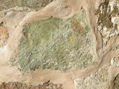
We started the field trip at Dingle Quarry, grid ref. SO765457. We began by examining a range of igneous rocks in a garden wall just above the quarry. See pictures below:
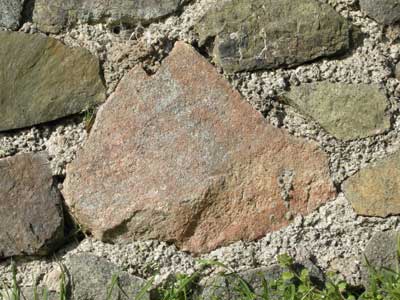
Pegmatite granite
We returned to the quarry, which exits at two levels, a lower and an upper level. The quarry exposes a mixture of igneous rocks, with early granites and diorites intruded by later dolerites, and shows extensive faulting.
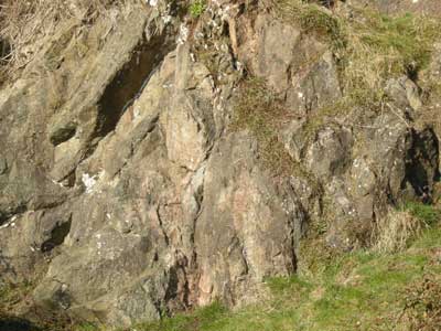
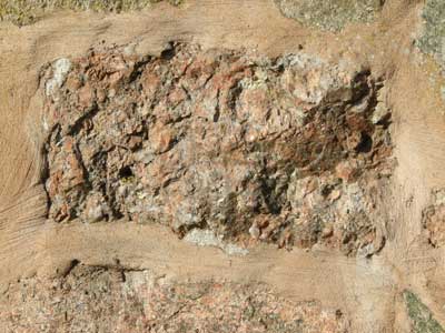
Diorite intruded by a series of pegmatite dykes. Lower level of Dingle Quarry.

The lower contact of a dolerite dykes in Diorite. Lower level of Dingle Quarry.

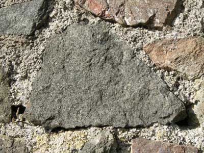
On the upper level of the quarry, we examine the contact of a dykes, which is intruded into a pink granite.
Location 2 – Sports Hall, North Malvern
We moved on to the North Malvern Sports Ground, grid ref. SO762473. In the raised bank of the South Eastern side of the football pitch Richard showed up the exposure below, which we examined.

The exposures is of Lower Silurian (Llandovery) sediments, comprising of soft mudstones and lenses of pebbly sandstone.
A piece of the Silurian (Llandovery) mudstone.

A piece of the Silurian (Llandovery) sandstone.
Location 3 – Tank Quarry – Malvern
We next went to the car par about 100 yards South East of the North Malvern Clock Tower (grid ref, SO768470). The East Malvern Fault is well exposed here.
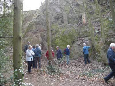
The group examining the East Malvern Fault at Tank Quarry.

Slickenside evidence associated with the fault, indicating the most recent phase of movement.

The crush zone of the fault. Note the angular pieces within the cement of the fault zone. Known as a fault breccia.
Location 4 – Cowleigh Park Farm
We parked at the small car park just beyond the Lord Beauchamp Well (grid ref, SO76604754). We headed North along the Worcestershire Way.
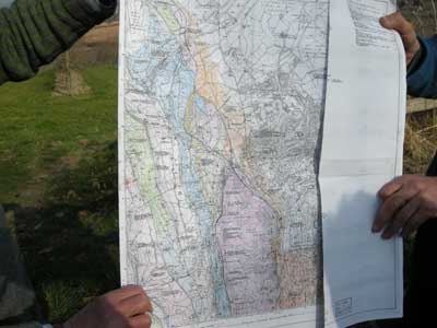
We stopped after about third a mile and Richard examined the geological map. We were walking roughly among the line of the East Malvern Fault. The red area is Precambrian granite or diorite, which we were now heading away from. The orange areas to the East are Triassic sandstones, making a part of the flat Worcester Basin. The blue areas to the West are Silurian limestones, sandstones and mudstones. These old rocks have been faulted and folded by the same thrusting pressures the caused the East Malvern Fault.

A view of the Worcester Basin, looking East.
Location 5 – Junction of Moorland and Graham Road

We stopped at the junction of Moorland Road and Graham Road, opposite the Nag’s Head pub (SO777469). Looking North we looked at the terraced landscape caused by the sandstone bands within the Triassic Eldersfield Mudstone Formation. There sandstone bands are called skerries. The picture here does not do justice to them, a wider panoramic view is required. Richard said that a good spot to see them is on Malvern Link Common, South of the Fire Station.
It is interesting to note that in the name “Malvern Link”, lynch (from which link is derived) is Old English for Terrace.
Location 6 – Knapp Nature Reserve
We parked at the small pull-in by the bridge where the Cradley Brook crosses the Suckley Road, near the entrance to the Knapp and Papermill reserve (SO751522).There is an outcrop of Triassic Bromsgrove Sandstone there, and Richard pointed out some interesting featured in it.

Fine bedding in the sandstone.

Course bedding in the sandstone.

An embryonic fault.
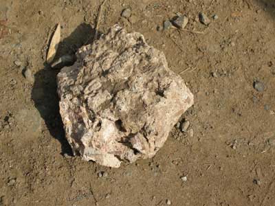
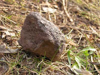
Richard showed us a piece of Haffield Breccia he had chipped off earlier. As the road is somewhat dangerous, he did not think it advisable for the group to see the location, which is further on up the road, going West. We examined the rock which was very solid, like concrete. It is Permian in age, so older than the Triassic Bromsgrove Sandstone.