Oyster Hill walk
The U3A geology group walked up Oyster Hill and the surrounding area on Wednesday 24 March 2010, led by Elizabeth Staley and Valerie Greenwood.
Much of the route covered a small section of the Geopark Way, pages 93 to 96. The Geopark Way book produced by the local Earth Heritage Trust. You can purchase it from Herefordshire and Worcestershire Earth Heritage Trust; Geological Records Centre; University of Worcester; Henwick Grove; Worcester WR2 6AJ (01905 855184).
Click here for:
· Maps
Don’t forget to click down into web links for additional information. These are generally accessed via highlighted words on the titles of the pictures.
Maps
Map

Geological Map
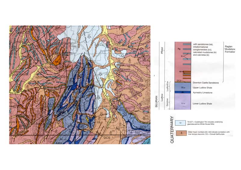
Visit report by Valerie Greenwood
On 24 March interested members of the U3A geology group walked a circular trail from Colwall Church over Oyster Hill to Wellington Heath and then back again via Frith Wood and the valley below Hope End. The weather forecast was suspect, but in the event turned out to be good, with moments of sunshine. Nineteen members set out, with an extra joining us for lunch and the afternoon walk.
We met in Colwall church car park with Elizabeth Staley as the group leader and Val Greenwood as back marker. After examining the sequence of rocks in the church walls, and noting the predominance of Downton Castle sandstone higher up, we set off along the road to cross the valley bottom on towards Oyster Hill. Elizabeth explained it was obvious the stream was too small to have carved this valley and explained its ice age history with the story of the Colwall Valley.
The hills that the Geopark Way follows from here to Wellington Heath are all ridges of Silurian limestone. Between the ridges are vales of the softer shale. The hills are heavily faulted which has resulted in a beautiful landscape of cross cutting valleys and ridges. This was confidently explained by Elizabeth on various stages of our climb, also relating what we could see to the geology map she carried.
At the top of Oyster Hill we stopped for a drink and to appreciate the view looking across the red soils of the Old Red Sandstone age towards the hills beyond Hereford and (on a better day) the Black Mountains of Wales. While Val phoned in our lunch orders to the pub, Elizabeth explained the closing of the Iapetus ocean, the joining of England and Scotland and the Caledonian mountain-building age. Coming down to the road cutting, after Hope End, we had the opportunity to examine the Upper Ludlow shale on the left and the Aymestry limestones on the right, noting the dip to the SE and looking for the thin layers of Bentonite in the recesses.
We took a mid walk break for lunch at the Farmer's Arms, Wellington Heath. Our orders appeared promptly and the staff were very friendly and helpful.
On leaving the pub we crossed the valley to Frith Wood. Looking back to Wellington Heath you could see the synclinal fold, a downward fold with younger rock in the centre. To the south-west in the distance we could see a further up-folded area of Silurian limestone forming the Woolhope Dome. We followed the path to a small disused quarry which clearly showed the dip in strata. The rock is a Silurian siltstone containing nodules of limestone. The loose material close to the path contained numerous fossils for us all to find.
We then retraced our steps along the edge of Frith Wood, and returning north-east toward Colwall we could see more evidence of faulting in the valley below Hope End. Eventually a path that crosses Cradley Brook took us back to the church. The last two cultivated fields will be remembered for their sticky mud, most probably ice-age lake deposits. After 15 minutes of frantic boot cleaning we returned home just before the predicted rain came.
The walk itself
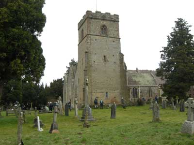
The walk started at St. James’ Church, Colwall. Map Reference SO739423 (point (a) on the map).
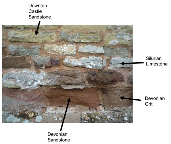
We examined the building stones used during the construction of the Church.
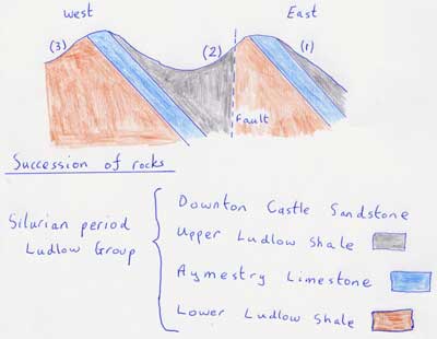
Leaving the Church and crossing the Colwall Valley, we ascended, crossing two wooded ridges (point (b) on the map). The geology of the underlying rocks is shown schematically in the diagram above. The Aymestry Limestone was originally one continuous layer, but has been broken by a fault. Movement on the fault has dropped the Western rocks by several tens of metres relative to the Eastern ridge. The two ridges now have a similar altitude.

Point (1) on the ridge diagram. The walk up to the first ridge.

Point (2) on the ridge diagram. Walking on the Upper Ludlow Shale between the two ridges.
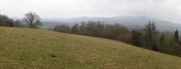
Point (3) on the ridge diagram. On Lower Ludlow Shale, starting the ascent to Oyster Hill. Note the Malvern Hills in the distance. The summit of Oyster Hill is on Aymestry Limestone, no doubt due to further faulting.
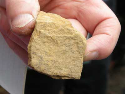
We examined a small quarry a few hundred metres North of the summit. This is point (c) on the map above, and is also shown on the Geopark Way map (page 90). According to the geological map this area is Upper Ludlow Shale, becoming Downton Castle Sandstone South of the road. However, we found yellowy sandstone, as pictured in the quarry.
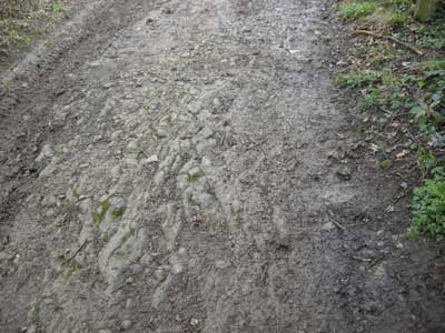
The road leading down to the quarry. We thought this was likely to be a mix of shale and limestone. Note the dip at this point which is around 45 degrees to the West (being on the left of the path in the picture).
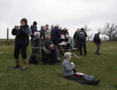
The group has a well earned rest at the at the summit of Oyster Hill (point (d) on the map).
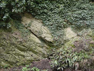
We examined the exposures in the road cutting approaching Hope End Farm (point (e) on the map). On the Northern side of the road the rocks are Upper Ludlow Shale, and on the Southern side they are Aymestry Limestone. The picture above shows the Upper Ludlow Shale.

A closer look at the Upper Ludlow Shale.
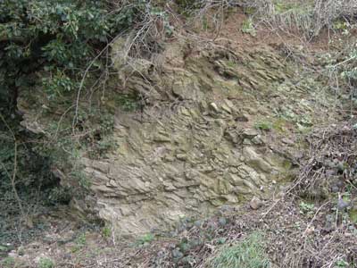
Aymestry Limestone exposure on the Southern side of the road.
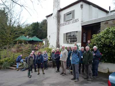
Lunch at the Farmers Arms at Wellington Heath (point (f) on the map).

We now walked from Wellington Heath to Frith Wood. The valley here (looking West) is a synclinal fold, with Old Red Sandstone in the valley base.

We examined a small quarry on the Southern edge of Frith Wood (point (g) on the map). The rocks in this quarry are a Silurian siltstone containing nodules of limestone. We looked for fossils.
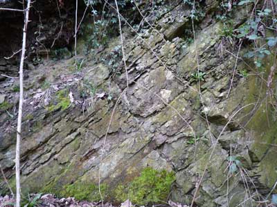
The Northern side of the quarry, again with a 45 degree dip.
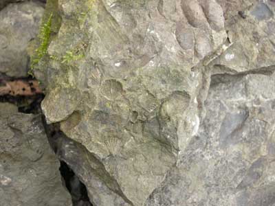
Some of the fossils we found, including brachiopods.
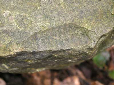
An Orthocone Nautiloid fossil.

As we walked back, in the penultimate field we encountered a field of till, (point (h) on the map). Till is the clay and sand deposited by a glacier; here this would have been in the last ice age. Also known as boulder clay it is extremely sticky. The picture shown Elizabeth’s boots.