Pembrokeshire day two – 8th Oct 2011
Day two itinerary
Breakfast 0730.
Leave by coach 0830.
Arrive Whitesands Bay, St David's Peninsular.
Lunch in St Davids, after tour of Cathedral building stone.
Walk St David's Peninsular.
Potential visit to Solva Harbour on way back.
Obtain provisions for packed lunch for Sunday prior to arriving at hotel.
For the information on the day provided by John Payne, our geological guide for the day, click here.
Write up of day two by Honor Berry
Whitesand Bay and St David’s Head are famed for their geology. We had been well prepared for our visit the previous evening when our leader for the day, John Payne, had given an excellent talk on the area and provided us with information sheets outlining the following day’s programme.
On arriving at Whitesand Bay we could only be impressed by the wondrous stretches of pure sands, which give the Bay its name, and the elemental nature of our surroundings. Straining against the noise of the wind, we clustered round John to hear his explanation of the geological goings on.
The early history of Whitesand Bay is encapsulated in the Precambrian rocks; they speak of violent volcanic activity generated by the subduction zone which once lay out in the area of the Irish Sea. These mighty Precambrian rocks manifest themselves as tuffs and ignimbrite, both of which were formed from volcanic ash thrown out into the skies 700 Ma ago. It is interesting that this same subduction zone and its ensuing activity may well have begun the process which ultimately gave rise to our own East Malvern Fault.
The Cambrian rocks (450Ma) which sit upon the Precambrian ones, represent quieter geological times notably the formation of the Welsh Basin which became filled with sediment. At Whitesand they appear as a conglomerate and also as a purple sandstone (Caerbwdi Sandstone).
Other geological delights include two impressive dolerite intrusions as evidence of volcanic activity in Ordovician times (490 Ma) and an intriguing raised beach of pre-Devensian age.
At Saint David’s, our next stop, we were able to visit the cathedral and see how the purple sandstone observed that morning, had been used as the building stone which gives the cathedral its characteristic appearance.
We lunched and tasted the local beer before setting out on the afternoon’s walk to Saint David’s Head. With good weather and lovely views on all hands we wound our way along the coastal path, John highlighting points of interest: Lingula flags, Carn Llidi gabbro and AberMawr shale. Unfortunately the garnet crystals we’d read about and hoped to find in the metamorphosed shales turned out to be something of a disappointment; if they’d ever existed, they didn’t any longer. But this was a walk with many interests including two ancient sites. At the First of these, an Iron Age fort, we could just make out the circles where houses had once stood and the entrance to the fort. Then we had a look at the Coetan Arthur megalithic burial chamber. Clearly this high spot looking out across the sea had long served as a place of strategic and religious importance.
Our tour completed, we returned to our hotel in Tenby, admiring the sunlit views across Saint Bride’s Bay as we went. It had been an excellent day.
Pictures from day two
Whitesand Bay
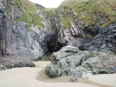
From the car park we walked to a
small cave, Ogof golchfo (washing place) at SM 7302 2644.
To the right we see basal Cambrian conglomerate dipping at 60°, and to the
right Precambrian tuffs.
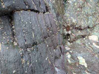
An unconformity. Ignimbrite to the left, Cambrian conglomerate to the right.
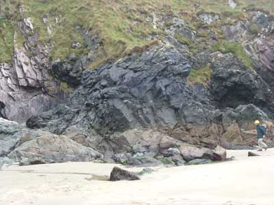
Ordovician dolerite intrusion.
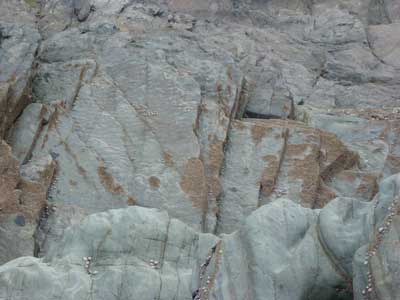
Ripple marks in Cambrian sandstone.
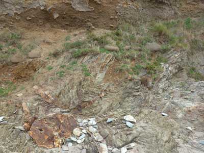
Cleaved Ordovician mudstone with till above.
Saint David’s cathedral
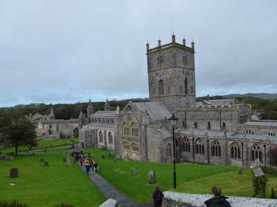
St. Davis's cathedral.
Saint David’s Head
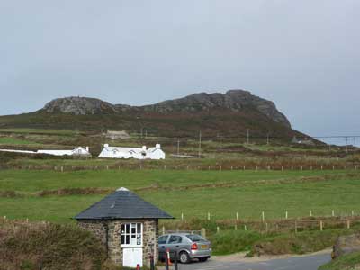
Whitesand Bay car park. (SN
734272). The walk started here.
Ahead we see Carn Llidi, a gabbro pluton.
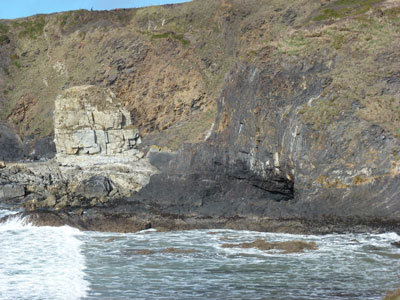
Rhyolite Ordovicion sill at Porth Lleuog.
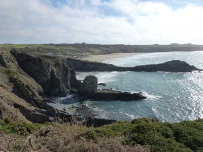
Porth Lleuog Bay.
In the centre is Trwynhwrddn (The ram’s nose), formed of Upper Cambrian Lingula
Flags.
This shale and sandstone headland would normally be subject to extensive
weathering, but is a fault zone riddled with quartz veining.
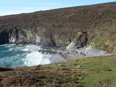
Porth Melgan Bay.
From this point onwards, there are two gabbro intrusions, separated by
Ordovician shales. This structure saw formed by a northeast trending syncline.
The picture is taken on gabbro / shale junction, and we examined the baked
nature of the rocks here.
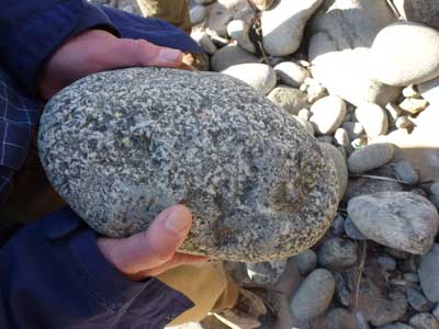
A piece of gabbro from Porth Melgan Bay.