MATHON WALK
25th JULY 2012
Overview
This walk was organised and led by Jim Handley and Dick Harris to explore the varied local geology in and around Mathon. The circular walk of about 2 ½ miles, starting from Mathon Church, explored the varying underlying rock types, evidence of ancient fault lines, evidence for the pre-ice age ‘Mathon River’ and finally the eclectic building stone mix of Mathon Church. The write up was written by Dick.
Additional information
A part of the walk follows a Geopark Way circular trail leaflet called “Mathon and the Malvern Hills”. To download this walk from the EHT website for free, click here.
Map

Mathon Church to Cockshott Hill
On this first section we left the area of younger Devonian Old Red Sandstone (~383 MYA) of the Mathon valley and travelled uphill to the quarry on Cockshott Hill and back in time to the older Silurian Limestone and Shales (~424 MYA) of the quarry. During this Devonian to Silurian transition we also crossed a thin band of Bishop’s Frome Limestone. We also crossed Cradley Brook noting that it flows from South to North.
The quarry is shown on the geology map as being in a small region of Aymestry Limestone closely bounded on each side by Lower and Upper Ludlow Shale. The appearance of the quarry rock is that of dirty limestone but it also has a ‘shaley’ appearance. The quality of the rock is poor and is used mainly as hard core for local farm tracks. The limestone is full of small fossils (mainly Brachiopods) which would have been deposited on the edge of a warm tropical sea when this part of the Earth’s crust was about 30 deg south of the equator. This sea was known as the Iapetus Ocean which later disappeared as a result of Plate Tectonic action (click here). This same action resulted in the building of the mountains of North Wales and the Lake District.
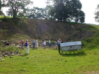
Cockshot Hill Quarry.

Cockshott Hill Quarry - Brachiopod Fossils.
The Quarry is also on a substantial fault line (Colwall Fault) with a vertical displacement of around 500 metres. We observed a distinct east to west ‘drop line’ of several metres in the terrain corresponding closely to the fault line shown on the geology map.
We then moved a short distance north of the quarry along the path following the line of the fault and observed what was believed to be ‘slumping’ ridges on the down slope of Cockshott Hill as a result of landslip. This was supported by the landslip symbol on the geology map.
Landslip on Cockshott Hill.
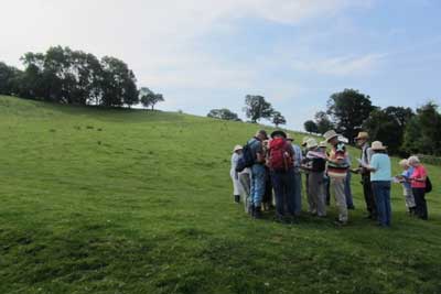
Cockshott Hill to Warner’s Quarry
On the next section of the walk we followed the footpath south which closely tracks the fault line. We continued to notice the E/W drop line in the terrain mentioned earlier. Shortly after rejoining the road back toward Mathon we turned off to Warner’s Farm and passed by the sand and gravel quarry (now disused). This sand and gravel was deposited partly by a pre-ice age river known as the Mathon River. This was a substantial river that flowed from North to South in the opposite direction to today’s Cradley Brook. The Mathon River deposited a variety of local material including Silurian Limestone and Malvern Complex and also material from the North including sandstones from the Long Myndd, coal debris and Jurassic fossils Around 450,000 years ago the Anglian ice sheet blocked the Mathon River and a glacial lake formed in the Colwall valley. Deposits of Clay, Siltstones formed at the bottom of the lake overlaying the sands and gravels. We were not able to see this directly at Warner’s Quarry at it is overgrown with trees and filled with water. However earlier pictures clearly show these layers of material.
When the ice sheets melted the area drainage system changed and Cradley Brook developed now flowing Northwards into Leigh Brook, the Teme and westwards into the Severn.
Warner’s Quarry to Cradley Brook and Mathon
Leaving Warners Quarry we walked westwards towards Cradley Brook. Just before crossing the brook we noted the evidence of earlier meanders in the narrow flood plain. After crossing the brook Jim showed us a collection of stones retrieved from the bed of the brook and also from the bank. This revealed a variety of local material the key feature being the angular rather than rounded nature of the stones. This is indicative of the material not having travelled very far.
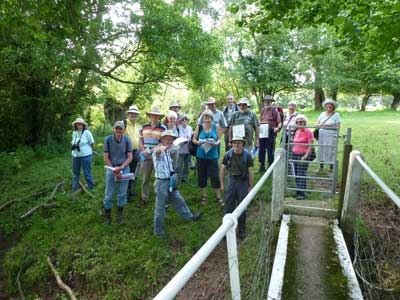
Jim explaining to the group the geology of Cradley Brook.
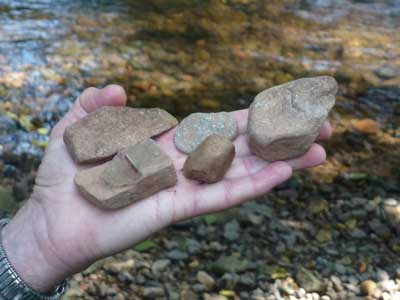
The variety of stones in Cradley Brook.
Climbing up from Cradley Brook we gained a good view back over the ancient Mathon River valley towards the Cockshott Hill Quarry which gave a good idea of how substantial the river was compared to Cradley Brook.
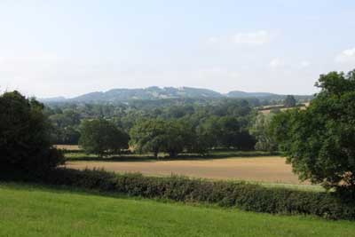
View to Oyster Hill over the ancient Mathon River valley.
Mathon Church
The final part of the walk was to explore the eclectic mix of building stones used to construct Mathon Church. The Church dates back to the 11th century with the tower being added in the 15th century.
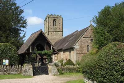
Mathon Church.
The predominant building stone is the local Old Red Devonian Sandstone on which the Church stands. However not all this material is actually red and we saw examples of green, buff and yellow varieties. Mixed in with this we were able to identify pieces of Precambrian Malvern Complex Granites, Cotswold Stone Lintels, darker Triassic Sandstone and one section of Calcrete Conglomerate.
Some of this material is not local and it is interesting to speculate how it was transported here.
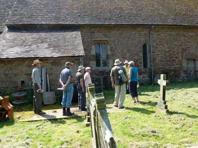
The group examining the building stones user in the construction of Mathon Church.
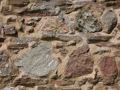
An example of the eclectic mix of stones used in the construction of Mathon Church.

Calcrete conglomerate used on the porch walls of Mathon Church.
To return to the home page, click here.