Mapping Sub Group
Dingle and Westminster quarries revisited
14 August 2013
Three members of the Mapping Group re-visited the Dingle Quarry, following Richard Edwards Guided tour last week, to tie up loose ends and confirm that we really understood what was described in various publications.
In the Dingle Lower level (i.e. at the roadside) we stood where John Payne has worked out Miss Phillips found the first samples of her conglomerate (see below). (Nothing visible now)
In the Dingle middle quarry we confirmed the orientation of the Dolerite intrusion/dyke cutting off pink granite columns (RHS of quarry). The dolerite clearly cuts both diorite and granites and so is the younger rock.
We traced the intrusions of granite and what is described as “dark material” into the Diorite, both the sharp edge contacts where there is a clear change from granite to Diorite and the ‘softer’ contacts where Granite and Diorite can be seen to be mixing representing different times and environments during the intrusions.
At the LHS of the quarry samples were taken of what we believe to be Gabbro and Pegmatite
In the Dingle top quarry we traced the clear contact between the Dolerite and the pink Granite which showed tectonic movement as cracks transferred across the contact joint . We were looking for foliation in the granite and found semi-circular marks we believed to be foliation marks and thought this might also explain the circular lichen patterns seen last week in the Gardiner’s quarry.
The Dolerite is supposed to show evidence of chilling against the Granite which would have occurred immediately after intrusion but we were unsure of what to look for. (? Smaller crystal size ?) we also failed to find a quartz fold described in the literature but did find some intriguing vertically faulted mix of diorite and pink granite which needs some explaining.
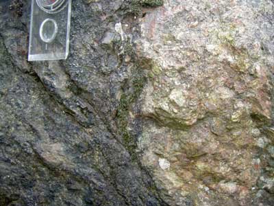
Views of unusual rocks and fracturing in the centre of the upper quarry.
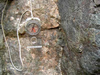
Views of unusual rocks and fracturing in the centre of the upper quarry.
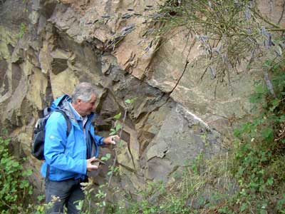
Phil Drake examining the intrusion and faulting in the upper quarry.
Extracting ourselves from the brambles (better to go in winter) we walked north along the path that bears off from the main track to the Dingle quarry and by the magic of GPS ( co-ordinates SO 76465 45940) we arrived at the in situ outcrop of Miss Phillips’ eponymous conglomerate, by the famous Sycamore tree . (If you remember, Miss Phillips’ important discovery, in 1842, of this mix of Malvernian Complex rocks and Silurian sediments as a beach formation established that the Silurian sediments post dated the Precambrian Malvern rocks)
We then carried on to the Westminster quarry which Richard Edwards couldn’t take us to. This quarry is predominantly granite with a 2m wide diorite band to the south which we could not find,(it was raining and lunchtime) so another visit is needed especially as the Diorite is supposed to have schistose appearance caused by metamorphism.
We did find a large area of slickenside on the granite in the middle of the quarry face.
Our best find of the day was the West Malvern Community cafe. Recommended.
Glossary ref.
Diorite http://geology.com/rocks/diorite.shtml
Gabbro http://geology.com/rocks/gabbro.shtml
Pegmatite http://geology.com/rocks/pegmatite.shtml
Dolerite http://en.wikipedia.org/wiki/Diabase
Slickensides http://en.wikipedia.org/wiki/Slickenside
Schistosity http://en.wikipedia.org/wiki/Schist
Foliation http://en.wikipedia.org/wiki/Foliation_(geology)
Documents used;
Richard Edwards’ handouts
EHT Champions project booklet
John Payne’s Miss Phillips Conglomerate location
EHT website
Nature Conservancy council’s students guide to the Malvern Hills
14 Aug 2014
Alan Hughes
Sue Chester
Phil Drake