Martley
21 August 2013
Led by Richard Newton and Geoffrey Carver
This walk followed Trail 2 of the walks produced by the Teme Valley Geological Society. To download the walk, click here. If not available, contact the TVGS. We also visited Scar Cottage Quarry, one of the Earth Heritage Trust Champions sites. Permission is required in advance to visit this quarry, contact the EHT for more information.
We gathered at the site of the old weighbridge (Grid Ref SO75365997) where Richard introduced us to the information boards provided by the Teme Valley Geological Society / Martley Geo-Village Project.
After crossing the road the kerbstones were examined and thought to consist of various rocks - granite, diorite, dolerite and others - all alien to the local area rock which is mostly Triassic Bromsgrove Sandstone. Following the field boundaries towards the Nubbins it was pointed out what diverse soil colours could exist between adjacent fields due to the underlying geology (a red Triassic sandstone) and their industrial use.
Climbing the Nubbins escarpment you could observe distinct steps in the terrain caused by quarrying activity for building stone over the past few hundred years. We followed a level track across the escarpment face which would have been used by the quarrymen to extract the stone and then ascended further to the first terrace below a quarry face.

Nubbins lower terrace quarry face.
A map of Pangaea was produced and the position of Britain was indicated during that period, which is where the northern hot deserts are located today. It was explained that when the tectonic forces relaxed a graben was formed now known as the Worcestershire Plain. This is where a braided river system called the Budleighensis River flowed, from Brittany through southern England, Worcestershire, Cheshire and out into the Irish Sea. This river carried a variety of sediments showing the conditions under which they were transported. The red colour of the rock of The Nubbins is due to oxidation during the desert conditions and is called the Bromsgrove Sandstone Formation. On examination of the quarry face cross bedding was observed indicating movement of the sand banks within the river bed and some thin layers of pebbles layed down during high currents. Calcite veins could be seen running diagonally across the rock face. The rectangular holes in the face were used during quarrying and the smaller round holes were used by solitary bees and birds. We climbed to the higher terrace below a quarry face for further exploration.
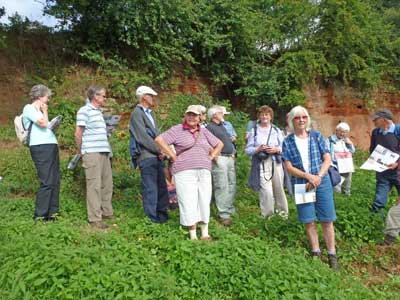
The group at the Nubbins.
Reaching the highest point of this dome shaped hill we took stock of our position. The Clent Hills, Bredon Hill, Malvern Hills, Bromyard Plateau, Clee Hills and Abberley Hills were all pointed out, most owing their existence to having been capped by more resistant rocks.
Crossing to the western side of the hill we met different rock types consisting of soft clays, mudstones and siltstones and the slope down towards the River Teme showed slump due to the weakness of the rocks and local springs.
We continued south west to Martley Rock Geology Site. Sir Roderick Murchison first wrote about the site in 1839. The Precambrian Malvernian complex rocks that form the Malvern Hills have their most northerly outcrop here. There was an old Victorian pit here where these rocks were quarried. In 2010 trenches were dug by members of the Earth Heritage Trust and the Woolhope Club. There trenches exposed the complex strata around the site. The East Malvern Fault (EMF) runs North South to the eastern side of the trenches, with Triassic sandstone to the east. The Martley Rock Fault (MRF) runs North South through the trenches, exposing the Precambrian rock between the EMF and MRF. But there is added confusion, with rocks from six geological time periods, plus an unconformity and a low angle thrust plane. All that within 50 metres. There were information boards and pamphlets were available at the site.
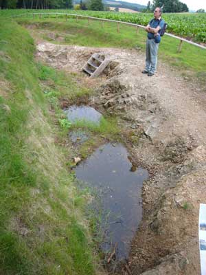
Geoff standing on the Precambrian Malvernian complex outcrop.
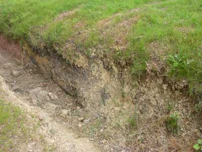
The
western side of the main trench.
The reddish coloured clay on the left of the picture is Silurian.Raglan Mudstone.
Next we have dark grey and orange clays of Carboniferous
Halesowen Formation. The beds are gently dipping,
and there is an unconformity between the Silurian and Carboniferous strata.
Next we have pale grey Martley Quartzite on the shear
zone of the Martley
Rock Fault. This quartzite has been thrust over the younger Halesowen
formation. There is some debate of the age of the Martley Quartzite, but is
either Cambrian or Ordovician.
Finally on the far right we have the dark mafic rocks of Precambrian Malvernian
complex.
We returned through the village and visited the Community Earth Heritage Champions project Scar Cottage Quarry. The quarry is at the eastern end of the Nubbins. The cottage back garden with a 10m high natural stone “wall” was explored.
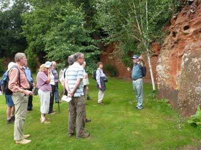
The group at Scar Cottage garden.
Taking the Worcester road out of the village, a roadside embankment exposure was explained. At the base lay Bromsgrove Sandstone, above that were thin layers of siltstone and mudstone formed in playas and topped by a white layer of hard sandstone.
The last point of interest was John Nicklin’s wall made from a limestone formed in a shallow sea.
We returned to the village and the Crown pub for some well deserved refreshments.
This walking trail is well maintained with plenty of information en route and would be of interest to non geologists.
Thanks to Richard and Geoffrey for a very informative walk.
(Write up thanks to Phil Uncles, plus RN).