Purlieu walk
6 Aug 2014
A mornings walk led by John Payne. This walk (mostly) followed the Earth Heritage Trust trail guide entitled “Wyche and the Purlieu”. This can be purchased from Herefordshire and Worcestershire Earth Heritage Trust; Geological Records Centre; University of Worcester; Henwick Grove; Worcester WR2 6AJ (01905 855184) ; cost around £2.
A map of the route followed is given below. The numbers refer to the pictures used below. Starting grid reference is SO 768437.
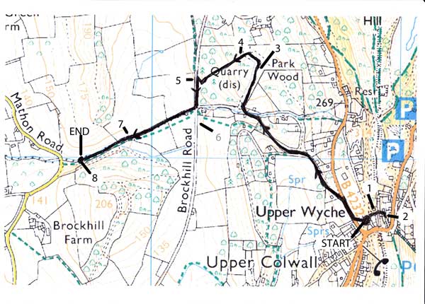
Route map
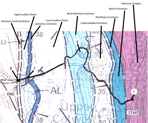
Geological map
The Walk
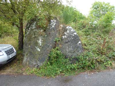
Outcrop of microgranite, map location 1.
Our first stop was at the top of the Wyche cutting where John showed us a large outcrop of microgranite. This, like the rest of the top of the hills, is a Precambrian rock. These Precambrian rocks were formed deep underground in a magma chamber around 670 million years ago (mya). John said that the presence of microgranite was most unusual, possibly unique, on the hills. He suggested it may have been formed as a later intrusion, 10 - 20 million years later than the main rocks. There are a number of other intrusions on the hills, but these are normally dolerite. The microgranite will have cooled more quickly than the main rocks, hence the smaller crystal size. Also it is probably harder than the surrounding rock which has eroded around it, leaving the outcrop standing proud.
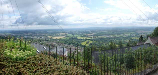
The view east from the Wyche cutting – the Severn plain. Map location 2.
Looking over the Severn Plain, John gave us a review of Malvern’s geology over time. The most obvious feature from this point is the sharp eastern edge of the Malvern Hills. This is a result of movement of the East Malvern Fault, a major geological fault extending from Cheshire to Bristol. It is a long standing fault, formed shortly after the creation of the hills themselves. The fault is a suture line between two terranes (mini tectonic plates). So, one would expect different rocks on either side of the fault.
Upward thrusting occurred in the late Precambrian, creating some form of hills. Evidence for this can be seen in the Cambrian beach at Whiteleaved Oak quarry (550 mya). Sea levels rose and fell until the Silurian period where there was a shallow sea with deeper marine rocks, ideal for the limestone deposition we see on the western side of the hills.
In Carboniferous times (350mya) mountain building phase created an east west compression. The rocks were pushed up, creating the shape of the Malvern Hills we see today.
In Triassic times (230 mya) the compression was replaced by an extension. A large valley was created, one side of which was the East Malvern Fault. This would have been twice the size of the Grand Canyon today, but had a substantial river flowing through it, depositing sediment. This had the effect of filling up the valley as it was sinking.
Following the Triassic period the sea rose. At the end of the Cretaceous the whole landscape was covered by a large thickness of chalk. The land then tilted 1°to the south east, the sea level fell, and erosion set in. What we are now left with in the Severn plain is an exhumed Triassic landscape. This is what we would have seen 220 million years ago, but of course it would have been a hot desert.
We then turned north along the B4232 for a short time, then west towards Park Wood. When on the B4232 we left the Precambrian rocks and entered Silurian ones. We following these for the remainder of the trail, each new sequence of rocks being younger than the previous ones. All but the last have been laid down in marine conditions, the type of the rocks being an indication of the conditions at the time. The rocks were originally horizontal, but due to the compression in the Carboniferous period (the Variscan orogeny) they have a 30 degree dip to the west.
On the B4232 we were walking on the Wyche Formation. John said that this here is mostly a sandstone of the Llandovery Group, the lowest division of the Silurian period (443 – 428 mya). It represents the edge of a sandy shore. There is then a very narrow layer of Woolhope Limestone, followed by the shales of the Coalbrookdale Formation. These shales are easily eroded, and we looked south into the slightly lower ground between the two bands of limestone. We progressed to this much wider limestone band, the Much Wenlock limestone.
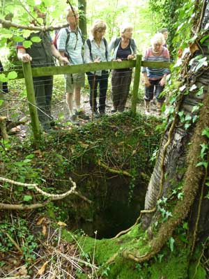
The limestone pit at Park Wood quarry. Map location 3.
We were now in a band of Much Wenlock limestone, which had been quarried in the past for lime burning. The raised ridge we stood on here is the unwanted spoil from the quarry. As mention before, the bands of limestone are tilted at a 30°, so the miners would be work down along the strike of the rocks to excavate the required material.
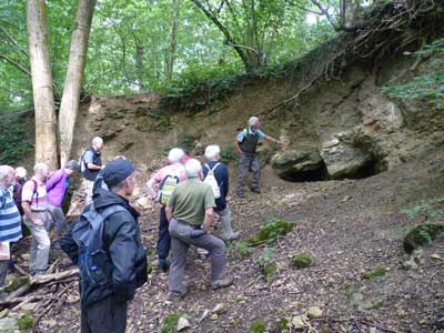
Park Wood quarry. Map location 4. Grid Ref SO 7640 4428
We examined Park Wood quarry in more detail. The rocks are Much Wenlock limestone, which was laid down in a shallow, tropical marine setting in the Wenlock era of the Silurian period. John explained the different environmental conditions in which the limestone was laid down. The lower, earlier rocks are generally unbroken, having been deposited in a shallow sea, some way out. The later rocks above were deposited after the sea lever fell. These were therefore subjected to more turbulence and were not deposited in such an homogeneous way. This mix of limestone and silt gave rise to the presence of pisolithic structures, similar to ooliths, but several millimetres across.
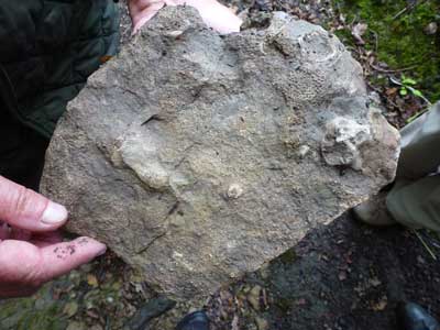
Fossils in the shale, from Park Wood quarry. Map location 4.
John showed us a patch reef, a coral structure now standing proud from the surrounding rocks. We also looked for fossils in the softer shale beds, finding corals and crinoids.
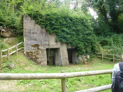
The limekilns. Map location 5.
The limekilns were built in 1907, and were used to burn the quarried limestone. The lime produced would have been used on agricultural land. There is evidence of much earlier limestone burning, going back to 1662.
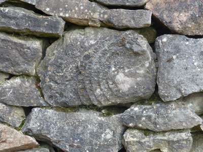
Fossil coral in the wall. Map location 6.
There are many interesting fossils to be found in the wall at map location 6. Here is a rather obvious one, a Favosites coral.
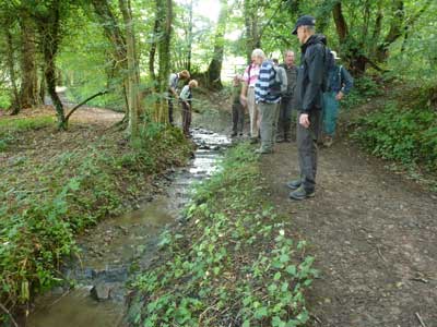
Limestone band in the stream. Map location 7.
The stream crosses the hard band of Aymestry limestone it this point. The softer shales are on either side.
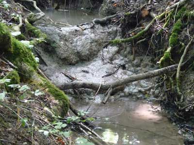
Tufa deposits in the stream. Near map location 7.
On a tributary to the main stream we found some tufa deposits on the rocks. This is a natural, recent phenomena. The limestone upstream is dissolved, and then for some reason (change of acidity, change of temperature perhaps) comes out of solution and is redeposited as tufa.
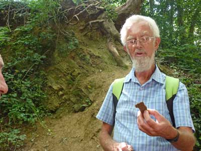
John finds Downton Castle Sandstone. Map location 8.
At this point the Lower Ludlow Shales turn into a thin layer of soft sandstone. This is the Downton Castle Sandstone (DCS). John pointed that it sparkled due to the presence of mica. This layer of DCS marks the transition between marine and terrestrial rocks, caused by falling sea levels. There are marine shales to the east, and Raglan mudstone to the west. John told us that, in the West Midlands, a bone bed can sometimes be found at this transition.
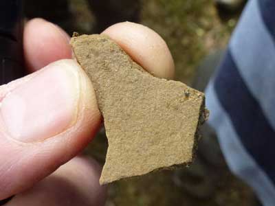
Downton Castle Sandstone. Map location 8.