Day 1, Locality 1
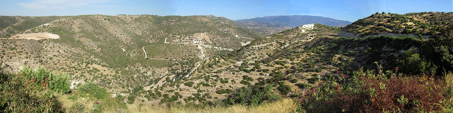
North of Kouris Dam on the B8 - viewpoint overlooking the Troodos foothills and Mount Olympos in the distance.
This first stop welcomes you to a week of unique geology. You are standing on well bedded, buff- to cream-coloured chalks of the Pakhna Formation, of Miocene age. The chalks are of hemipelagic origin, but facies variations are represented by shallower reefal carbonates in the lower and upper parts of the succession. The Pakhna chalks here dip to the south, and have strongly developed north-facing scarp slopes which are fault-controlled. Northwards, in the distance, the Troodos Mountains rise from the sedimentary plain to the summit of Mt. Olympos, on the skyline, at 1952m (6404ft). The high Troodos is composed of mantle rocks, their current position at nearly 2000m above sea level demonstrating the significant uplift of the plutonic core. Much of the faulting in the Pakhna (and lower) chalks is also related to this uplift. To the west (left), low hills of Mamonia Terrane lithologies are developed.
Click here to view Paul's inimitable introduction to the week - in either MPEG or WMV format. As with all of the videos on this CD they were hand-held rather than tripod-mounted so suffer from hand shake. Also from wind buffet on the sound track In most browsers hitting [F11] will toggle Full Screen on and off.. Afterwards click the browser back button to continue here.
Note that throughout this DVD reference will be made to two books: 1) Classic Geology in Europe, #7 - Cyprus, by Edwards, Edwards, Cann, Malpas and Xenophontos, first published in 2010 by Terra Publishing, ISBN-13: 978-1-903544-15-0, and: 2) GA Guide No.50, Southern Cyprus, by Trevor Greensmith, first published in 1994, reprinted 1998 by Geologists' Association, ISBN 0-900717-67-X. The first book (CGE-7) uses decimal Lat/Long coordinates while the second (GAG) uses Cyprus Grid references from the 1:50,000 K717 series of maps, published in the 1970's but now out of print.
![]()
![]()
![]()