North Malvern and Whippets Brook field trip
4th March 2015
Led by Richard Edwards
Overview
This visit was intended primarily for new members. For the main part it revisited locations that the Geology group had been to before with Richard- i). a silurian exposure near the North Malvern sports ground – see report of trip made on 19 March 2009, and, ii). the geology to be seen close to the Cowleigh Road in the Whippets Brook area – see report of trip made on 3 June 2009. In addition we looked at a new boulder in Tank Quarry and also at the recently cleaned section along the exposure of East Malvern Fault at North Quarry.
The Visit
Tank Quarry
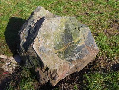
The trip started at Tank Quarry (SO768470) where Richard introduced us to a boulder that he had had moved to this site from further down the hill. This has very dark patches composed of a mass of black amphibole crystals. This rock type is called amphibolite. The lighter surfaces of the rock, including the light coloured veins, are of granite. The ampibolite is the older rock and would have been solidified and easily fractured at the time the molten granite was intruded-
From the nearby Viewing Platform there was a clear view to the north-east over the Severn Valley. Richard said that the rock of the Malvern Hills had formed around 670 mya some 10km below the land surface. It did not surface until the Cambrian period (540-485 mya) once the overlying rock had been eroded away. Much later, at the time of the Variscan orogeny (~310 mya), tectonic pressure from the east led to a thrust fault system developing in the Malvern area. Later still, the area was affected by other forces which pulled apart the crust to the east of the Malverns creating a rift structure. Over time this rift was filled with sandstone and mudstone to form the present day Severn Valley. The western side of this rift is marked by the East Malvern Fault (“EMF”). The EMF is an extensive structure stretching over 100 miles from Cheshire southwards to the Severn estuary.
North Malvern Sports Ground
We then drove to the North Malvern Sports Ground (SO762473)
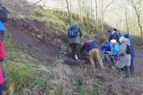
Here we saw a recently cleared exposure of rock from the lower Silurian age. Richard explained the cycle of erosion and deposition which led to the formation of the various strata in the Silurian: sands and muds were carried off the landmass to the east by river action and deposited in the sea (sandstones, shales, mudstones); later, in a warmer period the waters became clearer and limestones formed; then another episode of erosion and deposition, and so on. The oldest sediments we saw were sections of breccia and sandstone, with more-reddish sandstones and mudstones present further along the exposure and in a slightly higher strata level, the redness being from oxidation of iron and indicating that at that point in time the sediment was above sea level. We looked at the composition of these rocks and saw that the rock fragments in the breccia were very small and angular-
Whippets Brook
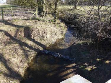
Then we drove to a car park on the B4219, at the spot where it is crossed by the Worcester Way (SO766476), to visit Whippets Brook.
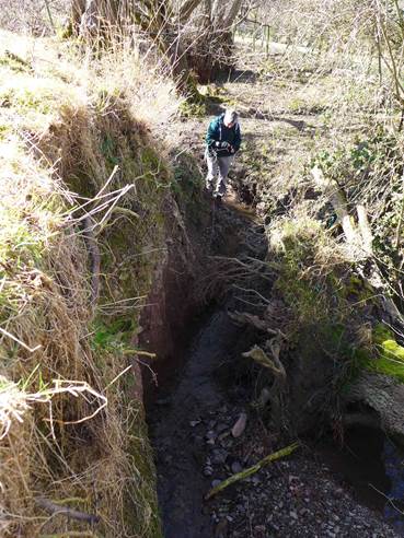
Walking northwards towards the brook, to the right the land sloped down through an orchard towards the Severn Valley below. The bottom of the slope marks the line of the East Malvern Fault. Soon our path sloped downhill to the Brook and there we saw the place where the river flows over the harder rock forming the boundary of the EMF and starts to cut down more deeply as it flows into the softer Triassic rock. The water level was low today, but when it is high you can see the orange colour of the Triassic mudstone-
As we crossed the bridge over the Brook we saw evidence of the last ice age in the river bank in the form of glacial “head” overlaying the rock-
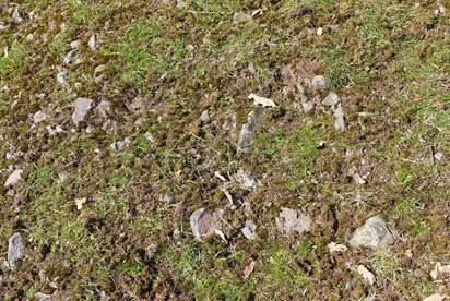
We then climbed the grassy hill to the right of Rough Hill Wood. Towards the top there began an exposure of rock fragments tightly packed in the ground. This is the Haffield Breccia, composed of fragments of Malverns complex rock cemented in place with sandstone and mud. The rock fragments are the eroded remains of a northerly extension of the current day Malvern Hills and the Breccia is thought to date from Carboniferous or Permian times (350-250 mya)-
After stopping on the hill to admire the view northwards along the twisting line of the East Malvern Fault we retraced our steps to the car park.
North Quarry
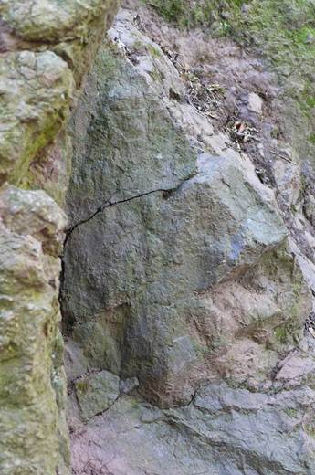
Finally, at North Quarry (SO771469) we looked briefly at the recently-cleaned section of the East Malvern Fault exposure just behind the car park. Richard pointed out the fault breccia. This represents the broken fragments (clasts) of Malvern Complex formed by disruption along the fault plane.
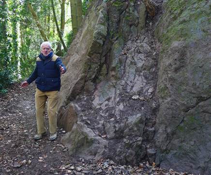
In addition we saw the almost-vertical striations called slickensides created when the moving rocks slide past one another along the fault.
Robert Eveleigh
March 2015