Frome Valley Field Trip
On 5 August 2010 members of the Malvern U3A geology group met to undertake a field trip to the Frome Valley led by Moira Jenkins.
There is a really excellent resource for this area, ‘Frome Valley Geology & Landscape Discovery Guide’, which was researched and written by Moira. The guide is indispensable and available from the local Earth Heritage Trust. You can purchase it from Herefordshire and Worcestershire Earth Heritage Trust; Geological Records Centre; University of Worcester; Henwick Grove; Worcester WR2 6AJ (01905 855184).
Moira gave the group a talk on the Frome Valley in 2009, click here for the write up.
The following account if the field trip has been written by Stuart Robinson, with assistance from Moira.
Click here for:
Pictures of:
Field Trip report
Overview
The main features of the area are:
- Sandstones of the St. Maughans division of the Devonian period form the northern uplands known as the Bromyard Plateau.
- Fine grained sediments of the Raglan Mudstone Formation in the Silurian period and overlying gravel deposits from ice-age melt water form the lowlands.
- Limestone and siltstone of Silurian period are found at Shucknall Hill and the Woolhope Dome.
- There is calcrete formation at Bishops Frome and Castle Frome. This unusual topic is covered in some detail. Below the village the course of the river follows a fault line which can be traced to the Neath Valley in South Wales.
Floods aside, the Frome is now a small river which is largely invisible in a bigger landscape. The river lies entirely within Herefordshire with its source in the uplands and a catchment area of less than 150 sq. km. (Published data refer to catchment of rain water gauging stations rather than rivers and the lowest gauge on the Frome is at Yarkhill above the confluence with the Lugg.) Moira explained during her earlier talk to the group that the river broadens at Yarkhill and islands were formed by deposition of debris in the middle of the river. Shortly afterwards the Frome is swallowed up by the larger River Lugg near Hampton Bishop not far from the confluence of the Lugg and the River Wye. The whole area around Hampton Bishop is a flood plain. The general course of the river in the uplands is north to south though there are sharp changes of direction where the river navigates around high ground at Bromyard exploiting weakness in the rock.
There is a clear correspondence between scenery and geology. One of the most striking geological features in Herefordshire is very familiar to motorists at Fromes Hill on the A4103, where the descent from upland sandstones to lowland mudstones is very steep. Sandstones are sedimentary rocks comprised predominantly of quartz (silica) with lesser amounts of other minerals. The red or reddish-brown colour in some sandstones is due to haematite iron ores containing ferric oxide (Fe2O3), but different colours were observed in outcrops on the field trip. Sandstones are porous, i.e. they contain voids or pores, while mudstones are softer and more easily broken down. River water transports suspended sediment downstream and the Frome and the Lugg are both very cloudy with mud particles. During periods of flooding the rivers overflowed their banks and as the flow rate dropped sediment was deposited on the valley floor (alluvium). Over a long period of time this deposition formed the floodplain.
The village of Bishops Frome lies near the foot of Fromes Hill and gave its name to a local limestone. The few outcrops were mined by the Victorians. They are no longer well exposed and so we were unable to visit a site. Limestones, marble, coral, chalk (not blackboard chalk) and stalactites are all calcium carbonate (CaCO3) which occurs naturally as the mineral calcite. There are no fossils in the Bishops Frome limestone though it is confusingly sometimes called a fossil soil. It formed on land as a calcrete over a period of low alluviation since it would have been eroded by river water. Calcrete formation occurs very slowly in definite stages. Groundwater dissolves minerals such as calcite though it is only sparingly soluble in water. As surface water evaporates in the heat of the sun subsoil water containing dissolved minerals rises. This evaporates in turn leaving a residue of amorphous calcium carbonate which slowly accumulates as irregular nodules. As gaps between the nodules are filled a hard impermeable mass is formed. These processes continue as long as a reservoir of calcite remains below the surface and appropriate environmental conditions prevail. Spring lines indicate the boundaries between rocks because overlying sandstone is permeable while underlying mudstones are not. The calcrete deposits were mined and decomposed in lime kilns into calcium oxide (quicklime) or hydroxide (slaked lime) both of which have many applications.
The Sites Visited
Swardon Quarry - SO 578 386 Explorer 189. There is a small car park with access by a minor road.
These were the oldest rocks viewed on the field trip and were formed from sediments which accumulated under sea in the Silurian Period. The exposure at the quarry is overgrown but the fossil of a colonial coral is quite prominent in the exposed face. There is a cleft where an impermeable layer of bentonite clay mineral was formed by breakdown of volcanic ash. Clay minerals are micro crystals of alumonosilicates in a layered structure with water molecules in the cavities. Other elements are also present as cations (sodium, potassium and calcium in bentonite). Slippage can occur at a layer of bentonite when rock beds dip down a slope and heavy rainfall induces instability. There was slippage of Aymestry Limestone overlying bentonite nearby in Dormington in 1844. The outcome was a massive landslide.
There is an especially good viewpoint towards Wales just above the quarry over the floodplain formed by the Rivers Lugg and Wye. (See picture in Moira’s guide). From here we took a ‘boundary’ circular walk back to the car park, descending a footpath along a dry stream bed to a minor road.
SO 575 384 - Looking down a farm track off a minor road.
There is a dipping outcrop of yellow sandstone on the boundary of rocks laid down under sea and those formed on the land near the end of the Silurian period.
SO 574 388 - roadside
We walked further downhill and observed another dipping outcrop from the Devonian period on the side of the road. This was deposited on land by streams. However, close by and just around a corner there were ripple marks on low rock outcrops. Waves formed these ripples on an ancient beach indicating that they had been formed in a shallow sea. The waves were frozen in time when the sand turned into sandstone. We were indeed on a boundary on either side of which rock outcrops had formed under completely different environments.
Shucknall Hill - SO 592 430 Explorer 202
After lunch we moved to the north side of the Frome Valley. The site was another disused quarry accessed by a steep minor road off the A4103 from where it is clearly signposted. Parking is limited off a rough track near a green. There is a short walk to the quarry with very good views to the south of the Frome Valley.
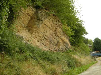
The rocks here have been folded upwards into an anticline. These older Silurian limestones and siltstones are therefore now higher than the younger rocks below in the valley formed in the Devonian period. The two types are separated by a major fault which continues to the Neath Valley. The top of the cliff was formed of Upper Ludlow Shales, below it were layers of Aymestry Limestone which is very hard and was used for road-building. The bedding planes are curved over the axis of the anticline and point to minor breaks in successive depositions.
Aide memoire Devonian period 417-354 Ma, Silurian 443-417 Ma.
Many of the wildflowers are species which flourish on limestone. The face of the cliff is colonised by moss and silver birch trees are taking root near the foot where there is considerable loose material containing fossils and streaks of coloured metals - manganese and iron.
Pictures
Pictures of Moira’s introduction
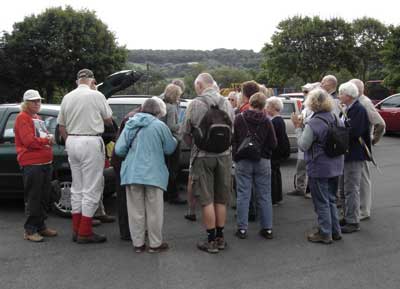
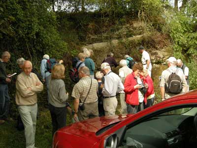
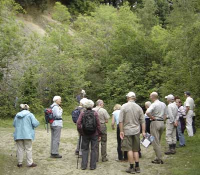
The group assembled at the start of the walk.
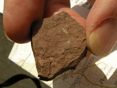
An example of Raglan Mudstone which underlies most of the lowlands in the area. Commonly called Old Red Sandstone, it is now considered to be Silurian in age.
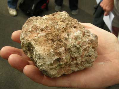
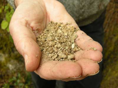
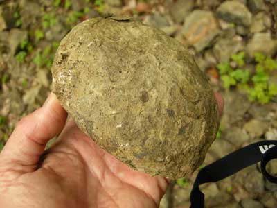
An example of Bishop’s Frome Limestone. This is a calcrete, or chemical limestone. Over time the water in the rock evaporates and lime is left as nodules of calcium carbonate. In places these layers can be 8 metres thick. The example here is quite an immature one, with quite a lot of soil left.
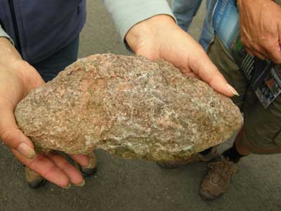
A mature version of Bishop’s Frome Limestone, most of the soil has now disappeared.
Pictures of Swardon Quarry(SO 578 386)
The group assembles at Swardon Quarry
Colonial Coral
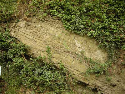
Bentonite clay, otherwise known as Fuller’s Earth
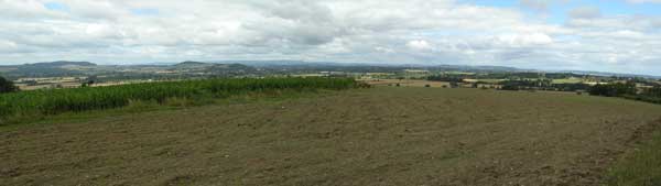
The view at Swardon picnic site, the Black Mountains on the horizon
Pictures of Sufton Lane, Prior’s Frome (SO 575 384)
Silurian Rushall Formation Yellow Sandstone (SO 575 384)
Raglan Mudstone Formation (Old Red Sandstone) (SO 574 388)
Ripple beds formed in shallow water (SO 574 388)
Pictures of Shucknall Hill (SO 592 430)
The group’s arrival at Shucknall Hill quarry
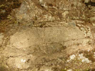
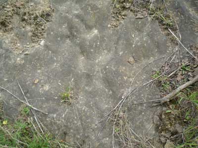
Nodule enriched in CaCO3
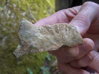
Finally two pictures of a brachiopod fossil, Leptaena depressa
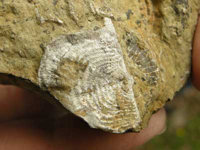
Top view of Leptaena depressa
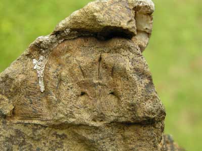
View of inside of shell of Leptaena depressa showing points where muscles were attached